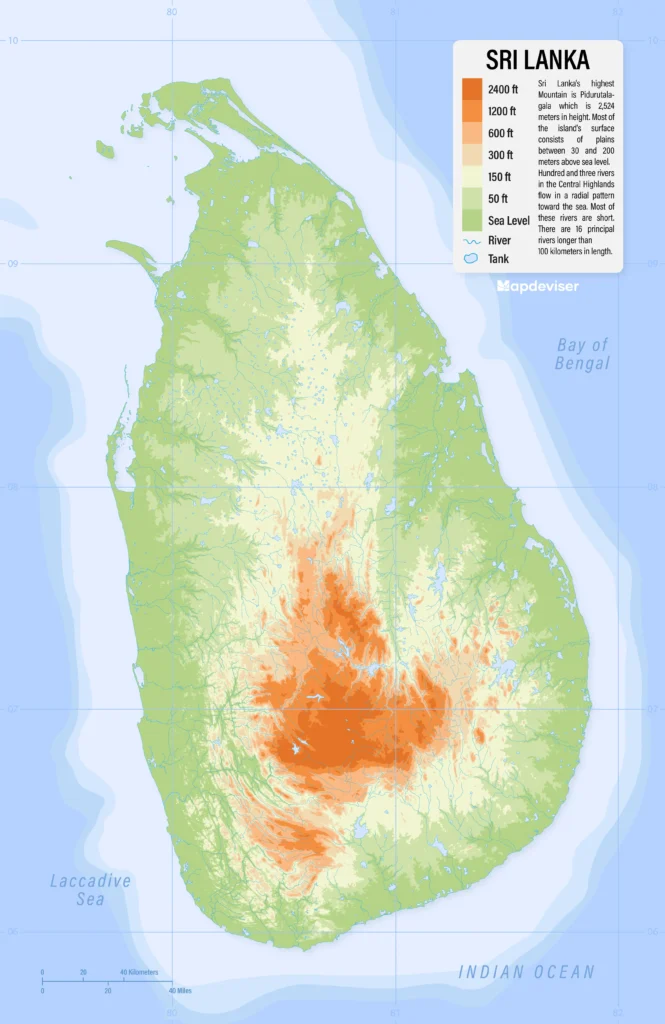
Discover Sri Lanka’s unique topography through our meticulously crafted elevation map of Sri Lanka. Designed with high detail and accuracy, this map provides a visual experience of the country’s varied elevations from coastal plains to mountainous regions highlighting its natural landscapes and helping you better understand its geographic diversity.

Whether you’re a geography enthusiast, researcher, student, or traveler, this map is an invaluable resource for anyone looking to explore or study the intricate elevation changes across the island. Download it for free and dive into Sri Lanka’s terrain details. Perfect for educational, professional, or personal use, this map is available in a user-friendly format to suit various needs.
Overview of Sri Lanka’s Elevation
Sri Lanka’s elevation ranges dramatically across three distinct zones: the coastal plains, the intermediate plains, and the central highlands. Each area boasts unique terrain, weather patterns, and ecosystems, making Sri Lanka one of the most geographically diverse nations for its size.
1. Coastal Plains
– Elevation Range: 0 – 30 meters above sea level
2. Central Highlands
– Elevation Range: 900 – 2,524 meters
3. Intermediate Plains
– Elevation Range: 30 – 900 meters
– Situated between the coastal plains and the highlands, the intermediate plains showcase varied terrain with rolling hills, plateaus, and rivers. This region is vital for agriculture, especially rice, which thrives in the stable climate.
Sri Lanka’s Highest and Lowest Points
1. Pidurutalagala– Elevation: 2,524 meters
– Elevation: 0 meters
– The low-lying coastlines host several major cities, such as Colombo and Galle, that play central roles in trade, tourism, and fishing industries.


